Indian removals in Indiana followed the land cession treaties starting in 1795. Some removals occurred prior to 1830, but most took place between 1830 and 1846. Not all Native Americans willingly left the state. The Trail of Death was a forced removal.
Lands Lost By Native Americans
Much, if not all of the information on this topic has been covered in previous pages. If you have been reading this series in order, you will have noted the loss of lands and removals of Natives in these pages: Pre-Revolutionary Wars, the Revolutionary War, Post-Revolutionary Wars, and Indiana Takes Shape.
Our story begins and ends with the Potawatomi in Pulaski County. While we started with global ice ages, the telling of our story ends at the western Indiana State Line. If you want to know the sheer depth and breadth of the land lost – land once “owned” by Native Americans – take a look at a map of the world and focus on the hemisphere that encompasses North, Central and South America, including the nearby islands and archipelagos. Native Americans, until 500 years ago, owned 100% of the land.
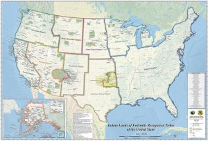
A Fascinating Interactive Link
Follow this link for an interactive time-lapse map that shows the loss of more than 1.5 billion acres from Native Americans: LINK
This link has issues. Issue number one is that this shows lands lost as of the Revolutionary War. This was nearly 300 years after the first Europeans landed on our shores. Issue number two is that certain sections – the original thirteen colonies plus additional adjoining territory, part of Texas and Louisiana, a small portion of California and a section near the Canadian border – are not presented as lands lost to Native Americans. They were.
Summary
This page was going to pull information from all of the other pages on this site, but we believe the link, even with issues, says more than words can say.
The Series
- Indigenous Peoples of Pulaski County
- The Land, From Ice To European Arrival
- The People, From Ice To European Arrival
- Europeans Arrive
- French Fur Trade & The Beaver Wars
- Indian Wars, Pre-Revolutionary War (The Colonial Wars)
- Revolutionary War
- Indian Wars, Post-Revolutionary War
- United States Takes Shape
- Indiana Takes Shape
- Pulaski County Takes Shape
- Indian Removals, 1700 – 1840
- The Potawatomi, Keepers Of The Fire
- Trail Of Death
- The Chiefs Winamac
- 7 Fires of the Anishinaaabe