Town Park History
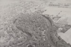
The land now occupied by the Town Park is situated on a natural and beautiful peninsula in the horseshoe bend of the Tippecanoe River. Tradition holds that this area had been a Native American campground.
For purposes of this article, we’ll just say that Pulaski County was formed by the State Legislature in 1835, and the Town of Winamac in 1839. The forced removal by militia of Native Americans from this part of the state – in 1838 – started at Twin Lakes, less than 22 miles from Winamac. It was known as the Trail of Death. The writer hates to leave it at this, but this history focuses on the park.
This writer has to say that she is fascinated by the history of her family, when and how they entered the county, how the towns and townships were formed, and just about everything that has to do with the “white” history of the State of Indiana and Pulaski County. That history can begin when Indiana became a state (1816), when the United States of America became a country (let’s just say 1776), when the continent was owned by a variety of European governments … To be frank, the history of these regions goes back centuries. Those stories will be told another day.
White settlers began to populate the area of Monroe Township, where Winamac is now situated, in 1838. When Winamac was platted in 1839, the peninsula and some surrounding properties were owned by W. C. Barnett, a pioneer resident. A county map published in 1873 shows the property still in his name. The area was known as Barnett’s grove, or Barnett’s peninsula. It was used as pasture for milk cows that were owned by several residents. Some of the virgin timber had been cut off, but it was still heavily wooded with second-growth trees. From local stories, it was a great place to graze cattle, or, if you were careful about where you spread your blanket, to go for a picnic. (I love that line. It was stolen from a newspaper….)
January 15, 1892
John C. Nye has bought from Horace Terry and Mrs. Hulda Agnew the six acres forming the point of the peninsula in the Tippecanoe river, paying $450 therefor, and he now owns the entire peninsula. When spring opens he will have the remainder of it cleaned and trimmed the same as has already been done to the east end, and will build a house over there to be occupied by a man to have charge and look after the grounds. He will also build a sort of office or waiting room in which his friends may loaf and smoke and tell their Sunday school experiences. A kite-shaped race trace a mile long clear around the point is not an impossibility. No use talking, the park is bound to become one of the most beautiful spots in Indiana. Pulaski County Democrat January 15 1892
In 1891, the land was purchased by John C. Nye, then a Winamac attorney, later to become Judge of the Circuit Court. He fenced off an area for cattle and added incandescent lights. While Mr. Nye owned the land, from 1891 to 1908, he allowed citizens to use the peninsula as a park. He also commissioned, through his father, the construction of an octagon pavilion.
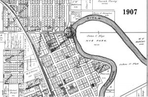
Over time, Mr. Nye discovered that trying to hold attractions that would raise money was not enough to cover taxes and expenses. Unable to sustain the park, Mr. Nye sold the land in 1908 to Ben Herrick. The new owner planned to convert the land to private use. On the day he began cutting trees, citizens banded together to raise funds to purchase the property. They raised enough on the first day to retire the debt, $5,000.
July 2, 1903
The foot bridge to Nye’s park was put in position the first of the week, but the heavy rains of last night raised the river so high that it was washed out. Not much, if any, of it got away, but it is badly twisted out of place. The dance that was to have been given by the young people’s club in the park pavilion tonight has been called off on account of the “flood effects.” It is said that several boats were broken from their moorings by the sudden rise of water and took quiet trips down the Tippecanoe. Pulaski County Democrat July 2 1903
Private Park Association
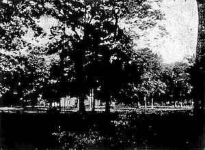
A private group, the Winamac Park Association, was formed. The organization purchased the land, allowing the “river park” to be used free-of-charge by citizens.
Fourteen years later, in 1922, the Park Association found itself in the same situation as Mr. Nye. They could no longer afford to maintain the park with the meager fees they were able to raise. The association reincorporated in order to raise funds. Also, at the end of 1921, the Winamac Kiwanis Club had been formed. The two organizations joined forces and imagined Winamac as a tourist destination.
The Park Association raised enough money to improve the river park on the peninsula. They purchased and installed new playground equipment, bath houses, a band stand, a dance pavilion and other amenities. A dedication ceremony was held on July 23, 1922, to celebrate the newly outfitted park.
March 19, 1908
The park across the river is to remain a park. There will be no cutting away of the timber or other devastation of this beautiful work of nature. For some time there has been on foot a movement looking toward the purchase of the property, and this has now taken definite shape. Part of the purchase money has been paid and the deed made out.
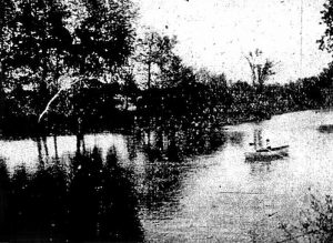
The property is to be bought and held by a stock company of citizens who have the interests of the town at heart enough to invest in the project. The purchase includes all of the peninsula, the old ball park and circus grounds, the east line being just west of the house and garden across the bridge where Ben Herrick and family now live. Mr. Herrick retains that part of the property and the timber he has cut, but the beautiful portion of the park, including the pavilion, is transferred to the company, the figure being $2,500.
Plans for maintaining the park have not yet matured – little has so far been considered except means for securing it. The purchase is prompted simply by the general feeling that it should be kept what nature intended when she made it and put the old Tippecanoe around it – a beauty spot. It is hoped that a permanent foot bridge can be built across the river, arrangements made for the accommodation of public gatherings, and the place kept in condition generally for outdoor recreation. Are YOU in? Pulaski County Democrat March 19 1908
West Side / Artesian Well
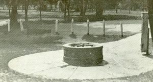
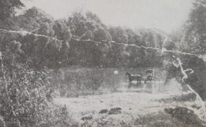
It cannot be determined from Town minutes, but either the descendants of Mr. Nye approached the Kiwanis Club, or the Club approached them. They family still owned land on the west side of the river. The plots of land included the plot upon which the historic artesian well was located. The area by the well was also the site of two local fords from the town to the park, and it was the place that both permanent (that never lasted) and temporary bridges were placed at the foot of either Main Street or Pearl Street.
A representative of the Kiwanis Club approached the Town Council with the idea of purchasing the land. Minutes were not specific, and it is unknown if the Town, at that time, envisioned another public park. While their intent was not clear in the minutes, they were amenable to the purchase. Water Street was vacated, and by 1923, this area had become a campground. The work of preparing the property fell to Kiwanis.
Permanent Footbridge
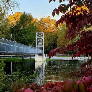
Either through invitation or self-driven in this regard, R. E. Nutt spoke to the Park Association about a suspension bridge that he believed could be installed for $2,000. The Association approached the Town, asking them to share expenses on a 50/50 basis. The Town agreed, so long as they did not have to pay more than $1,000.
Minutes from the Park Association were not found, but the two local newspapers kept townspeople up to date about plans for a bridge, a permanent bridge that would connect pedestrians from the town to the park, that would allow out-of-town campers to make use of park facilities.
The Park Association announced that bids would be received for a permanent bridge, with a requirement that it be completed by June 1. While they expected several quotations, only Mr. Nutt placed a bid. By the time the quotation was developed in March, prices of cement and steel had risen dramatically. The bid was for $3,197. The Town was represented at the meeting, steadfast in its determination to pay no more than $1,000. The bid was tabled to allow the Association to meet with Kiwanis and determine a path forward. Before that meeting could take place, however, a member of the Association went from business to business to raise funds. $1,600 was raised in a matter of days, giving them hope of moving forward.
One has to consider the time. In 1923, The War to End All Wars was still a raw memory. Pulaski County delivered 662 men to the War; thirty-three did not return. When the contract was signed with Mr. Nutt on April 6, 1923, the combined group of town leaders had determined the bridge should be dedicated to “soldiers and sailors” from the Civil War forward. Thus, it would be named “Memorial.” The completion date was pushed to July 1. Mr. Nutt left almost immediately for Chicago to procure supplies, and construction was underway by early May.
The Plan Comes Together
While Memorial was under construction, the Kiwanis Club put their members to work. The new town park was given a general clean-up and put in shape for use by auto tourists. “Combination dining tables and seats for the use of picnic parties” were constructed. Two camp stoves were erected and a cinder walk from the well to the footbridge was installed.
On the “river park” side, the Park Association made additional improvements. A twenty-foot-wide graded cinder drive from the road entrance to the park was installed to enable two rows of cars to pass. It extended through the park as far as the bathing bench. Another band stand was erected with lumber remaining from the previous footbridge, and a permanent refreshment stand was built that contained kitchen conveniences and refrigerator. An additional bath house was built containing eighteen private compartments, an office, and separate sections for men and women. Bathing suits were purchased for rental for men, women, and children. This bath house was for persons who could afford to pay. The bathhouses erected the year before were still available to the public at no charge. Gravel and stones were dredged from the beach, and depths on the now-sandy bottom were marked for bathers. Two additional diving boards at various depths were added. Steps were built to the water’s edge and a number of seats were placed on the bank for visitors to watch water sports.
All work on the two parks was completed, and Memorial was dedicated on July 4, 1923, on schedule. Information about this county treasure, this veterans’ memorial, can be found at www.memorialswingingbridge.com.
The Park Moves Into The Future
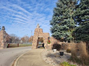
The 1930s brought several turning points to the Winamac Park. Stock was transferred and the land became the property of the town of Winamac. Plans for the gateway were made and busts of Native Americans were carved to adorn the entrance. Completed in 1934, the gateway has received national mention for its artwork.
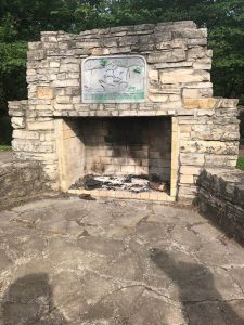
The Winamac Conservation Club was created in 1933. In 1940, the club financed a fish hatchery pond and erected a large open fireplace. The Club built a bird sanctuary and observation hut in 1941.
In 1931, Richard S. Rogers retired the park debt, with some stipulations, and he established a trust fund of $5,000. The $5,000 was to be dispersed upon his death, which occurred in 1945. His gift was used, in large part, to build new restrooms in 1950. The structure was to be made up of two small buildings, standing at opposite ends of a concrete slab, connected by a roof. Rest rooms, “equipped with electric pump and running water” would occupy one building, and the other would accommodate a concession stand.
In June of 1948, the Town of Winamac officially extended its boundaries to include the park.
In 1950, the Town Council granted control of the north end of the park to the fair board for use by their fair. The agreement was to run for thirteen years, giving the fair board the right to build, equip and maintain that portion of the park. Because the town could not lease park grounds, the fair board was given only partial control, during the month of August.
This ends the thumbnail sketch of the park. Read on to learn more about certain aspects of the park. As this piece is intended to be the story of the stone gateway, that story will come at the end.
